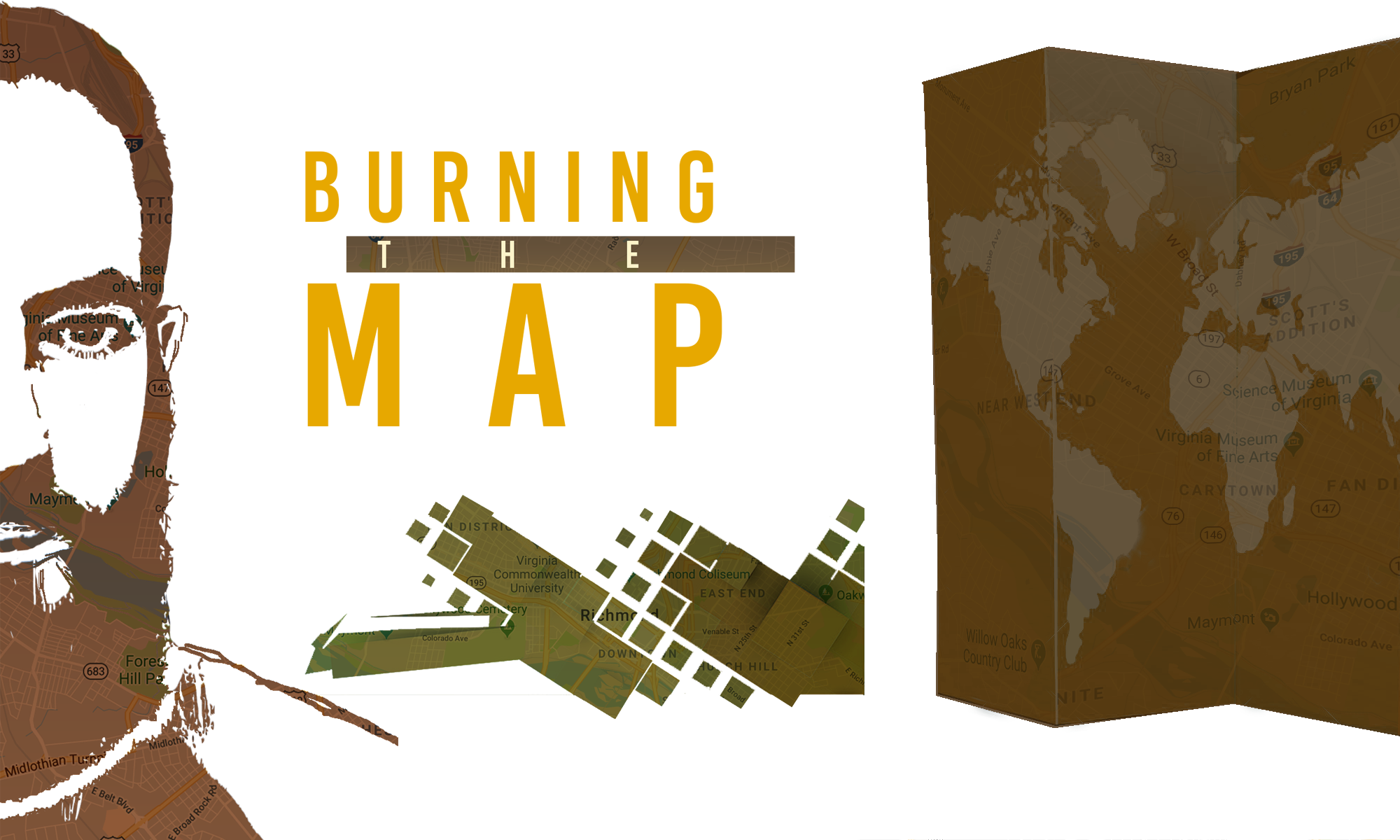
The place of kiwis. The place of mountains. The place of bays and glaciers and unique wildlife.
The people were kind, the scenery was stunning, and the hiking was next level.
In reflecting on my time in New Zealand, it’s a struggle to vividly remember it all. Three months is a lengthy adventure.
My arrival in Auckland seems like a year ago. Either that’s because my memory is as shit as I think it is, or time has been distorted by the amount of experiences I fit into that glorious 90-day window.
I met heaps of people. Many of them fleetingly, but a few kindred spirits that I could easily contact if/when visiting their home countries (and vice versa). I also picked up a little bit of lingo if you didn’t catch that usage of “heaps.”
On that note, probably the most valuable part of this trip has been the immersion into another culture. Even though it may have only been a subtle contrast to that of the U.S., it’s still an important process. I’m not going to sit here and say I’m a changed person or anything, but seeing the way other people live everyday life can at least open your mind to a different approach.
I wrote about the “no worries” attitude before and that’s something I hope I’m able to keep with me as I go forward. Everything doesn’t have to be taken so seriously. Things work out. There’s a lot of stuff out there we can’t control, so just take it as it comes. No worries.
By the Numbers
Days in New Zealand: 91 Days at Workaways: 43 Days with a Rental Car: 28 Nights in Hostels: 39 NZD Spent: ~$7,425.84 USD Spent: ~$5,017.46 (Avg. conversion rate of roughly 1.48)
Also, here’s my Trip Advisor profile. I was reviewing things pretty heavily up until I wasn’t. Maybe one day I’ll finish it out but it doesn’t seem likely.
Finally, I still don’t really know what I’m doing, but I think I’ve taken some decent pictures along the way. Kind of hard to screw it up with scenery that good. Below is an album with my favorite photos from New Zealand.
We forgot to buy coffee at the grocery store. This was a grievous error.
We were out of bed by 6am, on the bus out to Milford Sound by 6:30am and Zack and Hannah were caffeineless. Danger.
The drive out was actually pretty hilarious because they took like 4 separate naps.
Ethan, our driver, was giving us a commentary on the ride and they missed the majority of that.
We were extremely lucky with the weather we were getting though. We made a pit stop at Mirror Lakes because the conditions were perfect. Such still water, the reflection was pristine.
Mirror Lakes
We also passed by Lake Gunn, which looked even better. Unfortunately, we didn’t stop. I regret not asking him to pull over. It would’ve been an epic picture as the water was reflecting the snow-capped mountains in perfect symmetry. The golden light of the morning also gave an amazing contrast to the blue of the sky and the white of the snow. Man, what a scene.
Next, we pulled off to the side of the road where there was a Kea waiting for us. A kea is an alpine parrot species that’s become a somewhat pesky critter since tourists have been feeding them. They’re pretty cute the way they hop around though.
This one was familiar with Ethan apparently. It greeted everyone kindly, apart from Zack. It didn’t like the cut of his jib I guess and ended up biting his toe. Lolz.
This did not have a lasting effect on Zack as he went back to sleep when we boarded the van again.
After another 20-30 minutes drive we got to Deep Water Basin, where our kayak trip was launching.
Two consecutive days on the water was going to be epic. And the weather was even better than the previous day somehow. That’s really saying something because they get like 200 some days of rain in Milford Sound.
We met our guide, Mossimo, and got outfitted with gear.
The good news: GoPros would be in action. The bad news: the sandflies were absolutely everywhere and eating us to bits.
Once we were on the water it was alright but it was straight brutal beforehand.
Everybody else was coupled up, so I got paired with the only other single person – a girl from Slovakia named Makayla. Our boat fucking killed it too. I was steering in the back and we were in perfect synch. A decent amount of our day was spent waiting for some of the stragglers to catch up.
The water was abnormally calm for the first part of the day and the scenery was epic. It really was a redemption song from my first experience.
About an hour into the paddling, Hannah seemed like she was hitting a wall. Hunger and a lack of coffee was getting the better of her. I looked over at one point and she was draped over the kayak. Seemed dead.
It was a little bit of a stop and start situation again because there was one couple that was always lagging behind. We also had to cross a few boat channels which meant rounding up the group. Honestly, in terms of distance we didn’t make it all that far into the sound. If given the opportunity, I think Makayla and I could’ve seen a decent amount more.
The Dream Team
As the afternoon went on, the wind picked up and the water got more choppy.
The rocky beach where we had lunch was an awesome spot though. Hannah was happy once she satisfied the food and caffeine-shaped hole in her stomach.
For as beautiful as the scenery was, the sandflies were nearly intolerable during lunch. I think they’re particularly fond of Western blood because Zack and I were getting demolished. They really should’ve supplied some spray.
Our spot was quickly disappearing as the tide was coming in so we finished eating and got back out there. It wasn’t too far to paddle back to base.
Before we went to shore Mossimo told us the Maori legend of how Milford Sound was created. Kind of a fun tale if you care to read it.
I really enjoyed our time on the water. I’m a big fan of kayaking and rafting in general. With this scenery too, it was hard to be mad.
We shed our gear and then Ethan picked us up to drive us back to Te Anau. We made a few other brief stops on the return.
The Road to Te Anau
Lake Gunn in the Afternoon
The Chasm
It was a long day of being out but a sweet experience. With the extra stops and guiding, we felt like we got more than we paid for which was cool. Ethan did pretty well on tips too, so we joked that the beers were on him.
When we got back, we checked into our new room together (with a bed for me!) and showered up.
We ventured out into the burgeoning metropolis of Te Anau for a meal. Of course, we ran into Ethan at the restaurant. There was a wait for a table so he invited us to join him and a Swedish guy who was on his tour the day before us.
Amazing happenstance. Getting to know both of them was hilarious.
Ethan was like 24 but had been a sponsored BMXer, the skipper of a Marlin charter boat and a gold miner in Canada. He was also a ladies man with some comical stories. For example, he told us how he had a crush on this girl but ended up hooking up with her Mom when he was younger. Those days are apparently behind him now. He said he was ready to settle down and find a long-term relationship.
“Yeah. I’m the kind of guy you can bring home to Mom…Please bring me home to your Mom.”
-Nate Impersonating Ethan
Peter was a behavioral scientist for animals, working at various zoos and sometimes traveling the world as a keynote speaker.
We went to the “hip” bar for a final round. Ethan responsibly left first since he had another tour in the morning and then we parted ways with Peter. Another great evening.
Day 7 – The Imbalanced Ratio of Driving vs Stopping
We weren’t in a hurry in the morning, but we knew we had a long time on the road.
Our plan was to do what I had done a week prior and drive south through the Catlins to see some of the sights on our way to Dunedin. Only this time without the flooding.
It was roughly 5hrs of driving, not including stops. We had the key ones picked out.
After breakfast, we pushed off on our first leg of the trip — a somewhat plain drive through Invercargill (stop to pee) and onto Curio Bay.
Three hours later, we had arrived. Unfortunately, we couldn’t see any of the wildlife around but it was a solid vista. It was only a brief stop before we were onto the next.
Curio Bay
Then after another 45 minutes and some car sickness, we made it to our second stop — Purakaunui Falls. It was a short walk to one of the more unique ones I’ve seen.
Zack & Hannah at Purakaunui Falls
It was about another hour or so to Nugget Point. We had a solid chat about the healthcare system in America before we arrived.
It was a 40 minute return walk to the lighthouse that had some unique cone-shaped rocks just off the coast.
Nugget Point
Got back in the car. Roughly another hour long drive to Dunedin. Pit stopped near Balclutha to refuel and pee. Some more car naps. I was fading. Bland scenery? Unusual for New Zealand. At least we didn’t have to ford any floods. It felt a lot later than it was.
At long last, we entered the Dunedin city limits.
View from the AirBnB
We stayed outside of the city center at an AirBnB that was situated on a hill overlooking everything. It had a pretty awesome view.
The host was out when we arrived so we let ourselves in and got comfortable.
There was a debate on whether we should just make food and relax there or venture into the city.
The energy level was low.
I tried to encourage going to see some sites since they might never be back. That won out in the end and we had a pretty awesome dinner, featuring tasty pasta dishes and a full liter of wine. A full liter.
We met our host briefly when we returned. It was basically to set up our breakfast time for the morning.
Day 8 – The Swan Song
The Airbnb reviews really talked up Georgina (the host).
She provided some muesli and toast for us. She was definitely the chatty grandmother type. I think we left like a good 30-45 minutes later than we would have since she got on a roll.
It was good. Apart from the drunk shitheads in Queenstown and playboy Ethan, Zack and Hannah hadn’t had much of a chance to connect with a local.
She made some recommendations of places to stop on our drive up to Christchurch. It was another long day in the car. We had to get back at a certain point to drop off the rental as well.
We did pull off to see the Moeraki Rocks, do a quick drive by of the Oamaru steampunk museum and grab lunch but I don’t remember too much else.
Car naps? Oh, mos definitely.
We made it to our final destination a little before 4pm. We hustled to unload our things so we could knock out the airport excursion and get into Christchurch to explore.
Again, the 12 year old girls took a while to process our return (we’ve come full circle) but it got done and we caught the bus downtown.
I showed them the main highlights I’d seen – New Regent St, Cathedral Square, the Bridge of Remembrance and a few of the shopping streets.
We went to an “upmarket food court,” as a shop owner described it, for dinner. It was a large building with a ton of tasty looking restaurants all side by side.
Last Meal at Little High Eatery
I went HAAM on my last meal in New Zealand. A huge plate of seafood fried rice, some sushi and a big boy beer.
We decided it’d be a nice trip finale to go have a drink at one of the cool spots we’d seen on New Regent St.
We chose The Last Word, which looked like a vibey whisky bar. After a drink there, we were like why the hell not and went to The Institution across the street. They were both divey bars with a good selection and fun decor.
We had a comfy time on some couches finishing that beverage. Then the question of what we were doing next came up. Well damn. I’m usually not one to derail a night out but I had to leave a 4am to head to the airport. It was already 10:30pm and I still had to repack my things. The intelligent part of my brain said we should probably go back. I was up for whatever, so let the other two decide.
Hannah felt like staying out so we went back to The Last Word to have the last word.
I just thought of that.
I’m glad we did. Zack and I got in a giggle fit about how introverts could meet other introverts and get in a relationship without saying anything to one another.
It was an excellent way to finish off our time together, and my trip as a whole.
We Uber’d back to our…hotel room? It was a unique, boutique type accommodation with a bit of a weird vibe if I’m being honest.
The three of us destroyed our room rearranging all of our belongings. We said our fond farewells.
I got less than 2 hours of sleep. Thankfully, I woke up to my alarm and met my taxi.
After 3 months of living in New Zealand, I hopped on a 6am flight to Australia.
I was leaving what had become familiar territory to start a new chapter of this travel adventure. Mixed feelings that I’m only just now processing.
The Last Coin
The incredible thing, is that I somehow only ended up with this single 10¢ coin.
I’d say my experience was worth a whole lot more, but an overall rating of 10 wouldn’t be too far off.
I waited at the rental car counter for an hour. I was anxious because I had to drive back to the city to get my bags and then back out to the airport to scoop my people. They were already delayed a few hours so I couldn’t be late.
I was told the car was ready over the phone so didn’t expect such a long wait. Should’ve known. It seemed like the place only hired 12 year old blonde girls. I don’t necessarily have a problem with that as long as there’s enough on staff to see to the high volume of customers.
I got it, got my bags and got Zack and Hannah from the airport. Then we were off.
Our itinerary was pretty well planned out. At least our evening destinations were all booked, as well as a few excursions.
Our Loop Around New Zealand
Day 1 – Driving to Twizel
It was about a 4hr drive from Christchurch to Twizel (‘i’ as a ‘y’ sound).
The best part was coming over a hill to see Lake Tekapo with Mt. Cook and a few others in the background.
Lake Tekapo and Mt. Cook
We found a scenic lookout to pull over and snap some photos.
“It’s gonna be a gudday, mate.”
-Zack McDowell
And it was. We picked up some groceries for dinner and the next few days.
We were staying at an AirBnB that turned out to be epic. It was set up to be a ski lodge for a large group. Seemed a bit wasted on the 3 of us but no matter. We made a nice dinner and took advantage of the fire place and comfy sofas. Funny to think that we were probably knocking out our nicest accommodation on the first night. Oh well.
Z&H stayed up late enough for us to enjoy the digs (and hopefully avoid any major jet lag).
Day 2 – Our First Hike and the Drive to Wanaka
I left my shampoo behind. End of the highlights. (Wordplay)
Nah. We made a decent breakfast and packed up.
It was a 45 minute lakeside drive out to Mt. Cook. We were doing the Hooker Valley Track, which was an easy 3hr walk. I had found it on a top 10 list of things to do on the South Island. Boom. Poles and rain jackets were at the ready.
It was another well-kept track, but definitely the most crowded I’d walked in NZ.
Zack & Hannah at Mueller Lake
Mt. Cook was used as Mordor in Lord of the Rings and you could definitely see it. It was a gloomy day and the damp greenery combined with murky water made for a dramatic setting.
Hooker Lake
Mt. Cook
Swing Bridge
Even with the heavy dose of picture breaks, we made it back to the car in 3 hours. We gobbled down lunch and hit the road again. Off to Wanaka.
We had some good car conversation before Zack and Hannah dozed off. This would become a recurring theme. I will acquire photos.
The thing about New Zealand is, there are some stretches of road without a service station for a while. I knew this and had already had a low fuel scare so I was looking to play it safe.
Shortly into our drive we passed a small town and a sign that had distances for a mountain pass and the next two townships we’d be passing. No problem. There’s gotta be another small place with fuel before the climb up the pass.
Spoilers: There wasn’t.
After we’d gone about 30km and most of the way up Lindis Pass, the fuel light came on.
Not again, you dummy. Playing it safe usually means being overly cautious. So by ‘safe,’ I meant living on the edge.
I waited a bit for the other two to wake up. I didn’t want to worry them, but at some point I’d have to come clean.
We were all holding our breath. I coasted down the mountain so hard. I was acting like the gas pedal didn’t exist. Camper vans and trucks were whizzing past us.
We got down the mountain and kept hoping the next town would be around every corner.
Spoilers: It wasn’t.
There weren’t even signs updating us on how much farther we had to go. I was sure we’d be sputtering to a halt and flagging someone down any minute. The math in my head was telling me we’d gone almost 80km to whatever town was on the last sign.
Finally, we saw a community center. Where there’s enough civilization to warrant a community center, surely there must also be petrol. Shortly up the road we got to the country store that had it. Insane! No doubt we were rolling up on fumes.
Of course we had to go through the whole rigmarole of the payment station not accepting our cards. The clerk was closing up shop but allowed us to use her card in exchange for cash. I still don’t know why foreign cards don’t work at those things.
Either way, the important part is that we got our desperation gas and were able to carry on relatively unscathed.
By the time we got to Wanaka it was raining pretty heavily. Conditions made the tree in the lake a bit less picturesque, unfortunately.
After a brief stop to see it, we went to settle in and clean up at our respective hostels.
We had enough time to get to Rhyme & Reason Brewery before they closed. Zack enjoyed a tasting tray and ended up buying a bottle. Then we had to solve the age old dilemma of where to eat dinner. We ended up picking The Federal Diner, which was hidden down an alley way but likely the best meal we had the whole trip. Spirits were high. It was a good night and we were ready for the next adventure.
Rhyme & Reason Brewery
The Federal Diner
I was on the way back to my hostel when I got a message from Ellen, the Swedish lass I met up with back in Picton. She was also in Wanaka and looking for something to do.
I joined her for a walk around the town, which was silent. After chatting for a while, I invited her to join us on our activities the following day and through to Queenstown. She was interested and said she’d let me know.
Before bed, I got a message saying she was in.
Day 3 – Diamond Lake, Free Wine and onto Queenstown
We convened for breakfast in the morning. I quickly learned how important coffee is to Zack and Hannah’s daily routine. They got the goods.
Next, we went to the i-Site to sort out which walk we were going to do. There were so many in the area that it was difficult to decide.
Once we had our plan of attack we picked up Ellen. The track was just a short drive out of town so getting there was quick. We got a good start and the walk was awesome.
Another 3 hour track – Diamond Lake to Rocky Mountain Summit. There was a little bit of a climb but nothing too serious. There were several viewpoints looking back toward Wanaka over the lake and land. Rather spectacular for how little we worked for it.
Behold Wanaka
A Man & His View
Tools of Ascension
Contemplative Hannah
On our way out, we stopped at Rippon Vineyards. It was supposed to have good wine and awesome views, which it did. They were setting up for a wedding though. The venue price for this place must’ve been a pretty penny. I mean, seriously. The tasting room was still open, however, and the wine tasting was free/donation-based…toight.
Rippon Vineyard
Pinot Noir is the main grape grown in the Otago region. That worked because in the rare event that I’m drinking wine over beer, I do prefer reds. They did have this one that was a rare white grape that barely anybody in the world produces – Osteiner, I think. The bartender said that it was cheap but it might’ve been my favorite. No surprise with my simple palate.
After taking in the wine and the views, we ate lunch on the grounds. We literally sat on the ground and made sandwiches. Then we drove through to Queenstown.
Zack was geeking out on the approach. To be fair, driving through Frankton is extremely pretty with the way the houses are stacked up onto Lake Wakatipu.
We dropped Ellen off at her hostel and checked into ours. It was nice getting there in the late afternoon so we had some time to wander around.
I’d been around Queenstown enough during my previous visit to act as a de facto tour guide.
Tacos on a Boat
We got some delicious tacos and ate them on a floating boat bar. Zack geeked out again — I believe saying it was the coolest thing he’s ever done? Don’t get me wrong, Perky’s is moored right on the water in the middle of the city. The views were pretty exceptional. But, the fact that the boat had a bathroom on board took it over the top for Zack.
We were getting into a really good pocket of conversation when two young, insanely drunk local dudes came up and forced themselves onto our table.
One of them was somehow Brazilian, Japanese and Kiwi…with purple hair. We weren’t really sure how to parse that all out but he did a lot of talking and clearly had the whole world figured out. Told us some tale of his friend getting stabbed with a screwdriver.
The other guy was incoherent, from Punjab and dropped my camera.
It was an agonizing and endless waiting game for them to finish their drinks and move on. Somehow, we all endured and told them we were heading back to our rooms.
I checked my camera and noticed the viewfinder was no longer focusing. That really capped off the encounter. I later found out there was a diode I could adjust to dial it back in to be usable.
In the moment though, we were all bitter. That ignited a spark to go for another beverage.
We met up with Ellen at a western-themed bar called Cowboys, mainly because they had tabletop shuffleboard.
That dumbass experience was still in the back of my mind, plus karaoke was happening which was grating. Although the guys were killing it, honestly. One dude did like a 3-song set of 90s rap — “No Diggity” being the highlight.
We crushed some games and beers and moved onto another bar that I knew had cheap drinks. It just so happened that the terribles were also there. Thankfully they were too drunk to notice us so we skated by and had a few more beverages.
To end the night, we got Fergburger. It’s a Queenstown institution that usually has an insane line all the time. We got there and felt it was destiny because there wasn’t one. I heard a local walk past and say “Never seen that before,” in her amazing accent.
It’s tough to conclude whether the burgers are amazing or not under the circumstances. Regardless, it hit the spot and was a good way to conclude the evening.
The next day we had a summit to tackle. Depending.
People didn’t necessarily speak highly of it. I’d hear it was largely a university city. Much more sprawling than anything I’d seen since Auckland.
It was relatively quiet though, considering the students were away. Summer break. Man. I’m still not used to the whole season reversal thing yet.
Robert Burns Statue
It was a unique place, designed by a Scottish dude. I don’t think it was Robert Burns but there was a statue of him in the middle of the town, so maybe. Also happens to be my grandfather’s name.
The city center was shaped like an octagon, which I don’t think I’ve ever seen. The building architecture was also quite Victorian? I know that’s a thing…not sure if it’s an accurate thing. It was UK-esque anyways. An intricate train station, some cathedrals and shopping. Other than that, not too much doing.
Dunedin Train Station
There was a castle outside of town and the worlds steepest street, apparently. Unfortunately, I didn’t make it to either of those two attractions.
After a day of light exploring and sorting out my life and laundry, I hit the road for Christchurch. It was about a 5 hour drive and it was time for me to turn in my rental car. I’ve been cruising around in this thing for 20 days already. Hard to believe.
It was a rather uneventful drive; by New Zealand standards, a very boring stretch of land. I arrived in Christchurch mid-afternoon and checked into my hostel quickly so I could sort out the rental drop off.
I was eager to spend time walking around the city. There was supposed to be an interesting juxtaposition of new and dilapidated buildings due to a devastating earthquake they had in 2010.
ChristChurch Cathedral in Ruins
Can confirm the accounts as accurate. The cathedral in the city center was the most notable example but there were other completely modern structures directly opposite run down buildings too. Hopefully they’re able to renovate/reconstruct everything to tolerate the volatile earth floor they have.
Another unique thing about Christchurch was the street art. There were a lot of large murals around the city which reminded me of Richmond. I was digging it.
Street Art by Askew
Street Art by Wongi Wilson
It was time for dinner and I decided I would treat myself to a meal out since it was Thanksgiving back home. Since I’m still a cheapskate, I found a cool burger place that fit the bill. An old shipping container with a solid patio situation. Thursday was also bike repair night, so there were a ton of cool motorcycles there. Neat spot. Good choice.
Bike Night atSmash Palace
I walked around a little bit more before making my way back to the hostel for the evening. I had a little bit more preparation to do before Zack and Hannah arrived the next day.
First visitors, yay! It was going to be a jam-packed few days but promised to be an amazing time. We’d essentially be doing the loop I just finished, but it was an opportunity to tackle some walks and other activities I didn’t get to do. Plus, having familiar faces to share the last hoorah with was going to be sweet.
Pop some popcorn. I’m going to take you on a word adventure.
My journey up to Dunedin was brutal, you guys. I think I ran the gamut for vehicular challenges encountered.
My goal was to have a nice drive along the south coast with a few pit stops in key areas. The weather was shitty, but I was hoping it would turn good when I got to the eastern part of the South Island.
It didn’t.
[This has definitely become a blog complaining about the weather.]
I cruised through Invercargill and headed for a recommended spot – Waipapa Point. There was a lighthouse and shit.
As I arrived, it was, of course, raining but the wind was insane. It was blowing the car sideways at times. I got out and did a quick walk up to the lookout. Unfortunately, the view didn’t outweigh the unpleasantness of the elements. I decided to keep driving and just get the flavor of some spots from the car.
Waipapa Point Westher
I was almost all the way through the “Southern Scenic Route” before i had to turn around because of a road in flood. There was so much rain that rivers were spilling over onto main roads. I tried to troubleshoot the way around with another set of travelers. No luck. I spent a half hour on the phone with various NZ services trying to get information about additional flooding and alternate routes. I didn’t have any more cellular data and there was spotty reception anyway. It was a part of the country with a bunch of small gravel roads, so GPS wasn’t much help either.
Flood at Papatowai
I wasn’t given any useful info from the transit authority or council. I looked at a map and sorted out some possible options. The first few were a bust — I encountered several more impassable roads and a fallen tree obstructing another way. I tried to pull the branches apart for a bit and make a path. It looked like a car had somehow gone partially over it recently. In attempting to drive on the “shoulder” to pass it, my car got stuck in the mud. Thankfully I was able to reverse and get out. Close call.
Catlins Flood Route
I had to back track an hour and a half to find what I thought would be a reliable main road. I mean, look how close I was to being through it. Because of the extra winding, weaving and retracing, my fuel tank was on empty. I had a partially flat tire to boot and only a donut in the boot (trunk).
After adding 3+ hours of driving onto my day, I thought I was in the clear and bound for a late arrival at my destination, but an arrival nonetheless.
I came upon another flood just outside of Balclutha. It seemed small enough to drive through if I went on the wrong side of the road.
Success.
It was dark by now, and the relief I felt when I got on the main highway was quickly evaporating. The stress was creeping back in. There were no other roads I could use to circumvent any more blockages.
Then I came upon a road crew stopping traffic. To the right, I noticed somebody’s house under several feet of water. That fucking sucks. There were people trying to help move the water but…where was it going to go?
That’s when I noticed what was in front of me. Major water flowing across the road. This was the last main township before Dunedin. I was so close. Please.
One of the crew motioned me up to him. I thought I’d reached the end of the line.
He said my car would probably make it through alright, I just had to go slow. They were only letting through one person at a time so the water didn’t wake and splash up onto peoples engines.
It must’ve been just over ankle deep and my car was not tall. I didn’t see much of a current though, so that was a silver lining.
Two cars came through from the other way and it was my turn to ease through it. High anxiety.
With the depth of the water and darkness, I couldn’t make out the lines on the road. I was instructed to hug the high side but I couldn’t tell what was what or where it ended. Holy shit.
I turned a slow corner, spewing water from both sides and saw the other part the road block. Phew.
I came up the unintended boat ramp and wiped the flop sweat off my forehead. I waved politely and ventured on.
I’d barely gotten back up to speed when I saw yet another flood ahead. This one seemed deeper and with more of a current. There was no road crew ushering people through or to give advice here.
I’d made it this far and figured they wouldn’t be letting people through at the other checkpoint if it was dangerous. I slowed down and drove into it.
Once again, no road markings. No lights or markers in the distance giving me an idea of what line to take or direction to maintain. Occasional water splashing up onto the hood. The fan belt screeching from getting wet — and being a bit loose and shitty, but that was a separate problem.
I was moments away from fully freaking out. It was starting to rain again and the windshield was fogging and the wipers were being temperamental. I noticed, again, that my fuel gauge was bordering on ‘E’. What other issues could there possibly be? Was some sort of ancient river monster going to swim up and swallow me whole? In that moment, I might’ve welcomed that.
Oh yeah, I forgot to mention it was my birthday. Sweet. The beer was somewhere in the distance. I was determined to get there.
Finally, I saw some reflectors up ahead. I stayed on track and made it through ford number three? Seven? Twelve? Lost count. But thanks, Oregon Trail, for all of the practice as a youth. Couldn’t have done it without you.
The low fuel light came on again, so I pulled over in the next “locality” to fill up.
It was a small town, so all the shops were closed. They have single pay stations, as opposed to the pay-at-the-pump options like we have back home. Even though I did this procedure earlier in the day, it was refusing my card. I selected credit but it was requiring a pin. I selected checking but still declined. “Techmology – is it good or is it whack?”
I had no choice but to keep going. I fired up my GPS to check how far away I was. 32 miles. That seemed pretty sketchy to ride on empty.
A few miles later, I came through another small town. There was somebody filling up at this station too. Good deal. Maybe this payment system would be different.
As I pulled in, the other person was getting back in their car. I ran through the whole process and my card got declined again. Fuck. I had to stop the person from driving off to ask if they could use their card in exchange for cash.
The guy was like, “I’ll have to transfer money over. The most I could do is $20.” “Whatever you’re comfortable with. Will $10 get me to Dunedin?” “It should get you there.” “K.”
Holy S. $10 equated to a little over 4 liters, which is barely a gallon of gas.
It proved to be enough. The light came on again as I entered into the sleepy city center of Dunedin. It was 10:30pm. About 12 hours of problem solving had gotten me here.
My hostels reception desk was at the bar of the downstairs pool hall. I ordered a shot of whiskey while checking in. Two birds.
I hurriedly dropped my bags in my room and b-lined for the nearest bar. I realized I forgot my passport and usually they don’t accept a foreign drivers license as an ID. I almost turned around to give up but said fuck it and waltzed up to the place. No door man, thankfully.
I snagged a stool and a pint. Victory sip.
Then some incredibly gregarious, old Danish man started chatting me up when he saw I was left handed. After telling me why we were sinister, he asked to see my tattoos, asked if I was a numberphile and gave me all of his contacts so he could give me Danish lessons via email (without being prompted).
It worked out in the end because he had a cool, also tatted coworker who bought a round of scotch for my birthday. Gorm followed that up with a round of 22 year old Balvenie aged in Portwood – $28 per taste.
Deece.
We closed the place down and then I got invited back to have hot chocolate + cookies and watch Al Jazeera…at 2am.
I’ve always got time for the news.
Not really. But I did that night.
And that is the story of my 32nd birthday. Highs and lows. Life and death. Sinister and scotch. Hot chocolate and the news. I’ll take it.
FULL DISCLOSURE:
My posts are a few weeks behind real-time. At this rate, I don’t think I’ll ever be writing in present tense. I’m doing my best to catch up though.
This is going to be a short one anyway because my time in Te Anau was brief.
The town was incredibly small. It was more of a pit stop for people preparing for the great walks or doing tours in the Milford/Doubtful Sounds.
That was me.
I had to get on the road by 6am to catch my 9am boat cruise. I was prepared for rain because, you know, that was the new norm. I was not prepared for snow, which is what I encountered about 30 minutes into the drive.
The first official day of summer was like a week away and it was legit snowing. I didn’t pack for this, guys.
There probably would’ve been some awesome views along the way but visibility was low. There was an intense one-way tunnel that went through a mountain and joined a windy road down. That’s the area where the snow was heaviest, of course.
Waiting at the Tunnel
I arrived at the car park with some time to spare. I checked in and snapped a few pics.
Everybody raves about the beauty of Milford Sound, which is really a fiord because it’s been glacially carved as opposed to being formed by a river. I could totally see it. But it’d be ideal under better conditions.
Milford Pano
[Is this blog only weather complaints now? Sad.]
I was still excited about the trip. It was just a 2-hour cruise, but seeing things from the water is always a unique perspective. Plus there was the added bonus of a hot breakfast.
I loaded up my tray with an insane amount of food. Eggs, sausage, bacon, quiche, hash browns, yogurt and granola, toast, juice. You’d think I hadn’t eaten in a few days. And I destroyed it all before we were barely away from the dock. This honestly might’ve been the best part of my day, which is also kind of sad.
The upside to all of the recent rain was that the waterfalls streaming off the mountains were looking good. Some of the peaks were hidden by the low-hanging clouds — a familiar moody vibe.
What wasn’t hidden was all of the other cruise boats. They had the departure schedule staggered alright, but there was always another vessel in sight. I suppose you can’t really do much about that.
Other Tour Boat
The ride was surprisingly calm on the way out. Frigid being on the deck though. We had a false alarm of a dolphin sighting, which kept my no-interesting-marine-life-spotted streak alive.
We got out to the Tasman Sea and turned around. That’s when things got real. The wind was whipping fiercely and the rain picked up. It was like a video of a weatherman reporting during a hurricane. There were times where I was leaning diagonally to not be blown away. I nearly donated my hat to the sound on a few occasions as well.
The skipper sailed us right up next to a waterfall and two fur seals on a rock (you’re a dime a dozen, fur seals) and then we were docked. It happened quickly.
I drove away feeling like I missed out on the majesty of Milford. I didn’t like that outlook so was happy I’d be returning soon when Zack and Hannah came to visit. A chance for redemption.
On the way back, there was traffic. Odd.
I thought it was just the queue for the tunnel but this was well before the mountain climb up to it. Accident? Plowing? I wasn’t sure what was going on but ended up falling asleep in the car…for 45 minutes. I woke up in a daze and we still hadn’t moved. So weird.
Don’t worry, I wasn’t stuck there forever. We started going after an hour and a half. The reason why remains a mystery.
Will I ever find the answer?
Will the second trip be better?
WILL THE TOWN BE SAVED FROM THE POISONED WATER?!?
After a freezing night of sleeping in my car, I was onto another freezing activity: checking out some glaciers.
Sadly, because of global warming they’ve been receding at an insane rate. The only way to actually get on them is to helicopter and I wasn’t coughing up the funds for that. Instead I was planning to do a few short walks around them.
The Franz Josef valley was pretty insane looking. Clouds had descended (shockingly) and were creating a very moody setting. The main track was really easy; navigating the people was the hardest part. A ton of tourists. And as a fun note, I saw a woman wearing suede heals on the path. Clever choice. I see you, girl.
Franz Josef Valley
I think the closest you could get was 750m, so that was a bit underwhelming. I found the surroundings to be the coolest part. There was a good number of rocky peaks and waterfalls streaming off the side of the nearby mountains. Plus with a low cloud ceiling, it felt like I was in Jurassic Park.
I took my time walking back. Fox Glacier was only about a half hour down the road so there was no hurry. I later found out that the road to access that glacier was closed due to a landslide anyway. I guess once you’ve seen one glacier from afar you’ve seen them all? I was ok moving on.
Walking into Franz Josef Valley
Next on my agenda was hiking the Copland Track. It was a 2-day out and back of moderate difficulty. The main attractions were natural hot pools near the hut and swing bridges. It was also on my way south, so that didn’t hurt either.
I found a cheap place with a shower and kitchen so I could sort out my supplies and get clean. I repacked my bag for the two days, got all of my food made and turned in so I could get an early start.
In the morning, it was a quick drive to the start of the track. The parking lot was pretty full which was surprising. I found that all 31 spots at the hut were full the previous night. Kind of unheard of on a non-great walk track, though a good sign that this one was worth the effort.
I saw two guys getting started as I parked and gathered my stuff.
Basically right at the beginning of the walk you come upon large stream. Normally it’s probably not that high, but because of all the rain it was definitely an obstacle.
Similar to the Awaroa Inlet from Abel Tasman, there were several areas of water that were about ankle-deep and 10-15 feet wide. There were some spots where you could get about halfway across before getting stuck.
I stood there for 15 minutes like an idiot, getting bitten by sandflies, trying to figure out what the best plan of attack was. I tried moving some rocks around to make my own path. That wasn’t really doing the trick.
Two other hikers came along and briefly debated also. One guy, some super intense Dutch guy who had gaiters on, more or less waded across immediately. The other person took their shoes off and rolled up their pants.
Bleh. I didn’t want to get my feet wet so early but that was the only viable solution. The water was frigid and rocks sharp. Apparently I only walk on pillows because the bottoms of my feet are not tough. That mess hurt.
Copland Gorge Portrait
I made it across eventually and got my shoes and socks back on. I walked solo for about three hours. The scenery was kind of sweet; there was a nice variety. Eroding cliffs, calm clearings, several other stream crossings and rock hopping along a powerful river.
A little over halfway I reached a paddock where two other hikers had stopped for lunch. I set up shop there as well. The sun was out which was a new experience. It was a perfect spot to recharge the batteries for the rest of the walk.
Those two guys ventured on while I finished my food and relaxation. As I was getting back on the path I met up with the person I crossed the first stream with, Morgan from Reunion Island. We walked the rest of the way together and chatted.
We also got to share the experience of the two gnarly swing bridges. I mean, we had to go one at a time, but it was pretty insane.
The second half of the day was much more demanding walking. Steeper and more important where you were putting your foot. Then out of nowhere we arrived at the hut. It was in a serene valley looking right at the southern alps. Absolutely awesome spot. The best part is that it was only 3:30pm so we had plenty of time to take a load off.
Welcome Flat Hut
We sat down inside with the two guys from the lunch paddock, a Kiwi named Paul and a French-Canadian named Keran. After a snack, we all went to have a soak in the natural hot pools that were 100m away.
Welcome Flat Hot Pools
Epic. Our very own geothermal jacuzzi. Amazing for the muscles. I stepped in one of the tributaries leading into the pools and nearly burnt my foot off. Two of the three pools were maybe a little too hot, which is saying something. They were all really shallow so you had to kind of get horizontal and comfortable with the weird muddy bottom. Also submerging as much of your body as possible helped keep the sandflies away. But you couldn’t dunk your head under for fear of amoebic meningitis. Unfamiliar with what that is but not interested in finding out.
The four of us sat for a while and chatted. It was incredible to relax in that setting with that view. A few groups came and went as we stayed there pruning up hardcore.
We got back inside for our “safety talk” by the hut warden, whose barn burner of an opener was, “Welcome to Welcome Flat Hut.” After that, everybody pretty much just sat around and chatted for a while before going to bed early. The majority of the huts along the walks aren’t powered, so once it gets dark there’s not much going on.
The night sky was great but I couldn’t be bothered to deal with taking a long exposure. I should have. The image will stay in my brain for a little while longer at least.
In the morning, our impromptu group agreed to walk down together. We got a bit of a late start after they took another dip in the hot pools and I snagged some photos.
We were crushing the return journey even though it was a complicated descent at times. By hour four of our breakneck pace my left knee was in forfeit mode. I started falling behind even though we didn’t have all that much left.
I hobbled back across the creek and to the finish line as the rain began again.
Overall, it was probably the best hiking experience I’ve had in New Zealand. The hut was picturesque and having the hot pools right there was unbeatable. I’ve since invested in walking poles to hopefully alleviate some of the burden on my ancient leg hinges. We’ll see if they help. Please.
Instead, I was hamstrung by rain between Greymouth and Hokitika. Let’s just pretend that some interesting stuff happened and I didn’t spend 16hrs in a brewery mooching wifi and two nights sleeping in the car, eating endless ham and cheese sandwiches.
After 3 days, it was still coming down outside. I was stir crazy and decided it was time to push off. The trouble was that the main highway was closed in the direction I needed to go because of some landslides.
I had faith it would get sorted out when I got to that point. There were a few small walks I was doing on the way to buy some time.
Hokitika Gorge Swing Bridge
Unfortunately, the key attractions would’ve been a lot more remarkable in better weather. I did a lakeside track that would usually have an awesome mountainous reflection on a calmer day. I went to a sweet gorge with a swing bridge that would usually have beautiful blue water rushing underneath. The river was a curious gray color. Like the tint of the water you rinsed your paint brush in a dozen times.
There were still plenty of awesome sights along the way. The clouds were hovering among the mountains, often hiding the peaks like a jealous boyfriend smothering his girl.
One Lane Bridge Rd
I headed south toward Glacier Country.
My positivity was paying off because the clouds began to break. I reached the landslide area and got lucky. The road was reopened, just condensed down to one line. A short queue to alternate the traffic but no problem.
I was told to take a detour to Okarito. There were supposed to be some good views of the bay on the coast and the distant glaciers. It was a nice scene to start with but the view at the summit was still pretty obstructed by clouds. The inlet, however, was sweet.
Okarito Trig Walk & Inlet
I went to another spot that was supposed to be a 40 minute return. Somehow I went down the wrong track and ended up deep in the woods. After 30 minutes, I realized my error and decided to turn around. I did see a wild deer come busting through a clearing. On the way back I passed a guided group that was going in looking for Kiwis. I got a very confused look for being off the beaten path. Oh well.
I left to go camp nearby and planned to get up close and personal with some icy rocks the following day.
The rest of my adventure was going to be significantly different from the first bit.
For starters, I was going to be seeing an all new part of the country…obviously. But the main thing of note was that I got a rental car.
Mazda Premacy
Game changer.
Flexibility. Travel mates. Getting off the beaten path. Shelter.
From Abel Tasman, I hitched a ride to the Nelson airport in 3 phases:
To Motueka with a roommate from my hostel.
For like a mile with possibly the most attractive girl I’ve seen in NZ (she took me closer to the prime hitchhiking spot).
Finally, with a 70+ year old Dutchman who took us on a detour through Mapua for coffee.
I picked up the car and I was feeling so good. It was also such a beautiful day out that it’d be hard to be in a bad mood.
Straight away, I went to grab some supplies. The car was pricy so my plan was to save money by stocking up on food and sleeping in the car/camping as much as possible.
There’s this store kind of similar to Walmart called The Warehouse. Everything is super cheap. I snagged some cutlery, tupperware, a cooler bag and some other odds and ends. Then I went grocery shopping.
Boom. I was on my way to the West Coast.
The drive was actually unremarkable in the beginning — pretty typical farmland and countryside. I started to hit some gorges and interesting valleys right when it got dark, so that was kind of a bummer.
I arrived in Westport at about 10pm and was really looking forward to the coming few days.
Cue another rainy day.
I took that as a sign and decided to catch up on some admin type stuff. I went to the library since the hostels in small towns don’t usually have unlimited, consistent internet.
Westport Library
I was just getting into a state of flow when the library closed. It was 1pm on a Saturday. A lot of stores and restaurants will shut down at 3pm on the weekends. That’s a random bit of culture shock I’ve noticed — shops willing to close during prime money-making hours. I mean, fair enough. I cherish my free time as well.
Since it was still raining out and I wanted to keep taking advantage of that sweet, sweet bandwidth, I drove the car and parked it outside of the library. Still in range to mooch. Resume browsing.
After like two hours of sitting there, I realized I left the lights on so the battery was dead. Ya dumb dummy. I had a car again for barely 24 hours.
I got the kind hostelkeeper to drive down and give me a jump. Except the jumper cables weren’t working so I had to leave it overnight. Not a huge deal; it got sorted in the morning.
As I was preparing to check out in the morning, my roommate, a French guy named Alex, asked what my plans were. He was interested in going the same way that I was, but didn’t have much of a plan. How laissez-faire of him. I invited him to tag along being that company on walks is nice and all. His accent was tough to understand at times, but we got by.
I’m just going to rapid fire what we did because I don’t want to write a novella and you don’t want to read it.
The skies cleared as we did the Charming Creek Walkway over some old mining cart paths and a swing bridge to a pretty waterfall.
Hiked a 3 hour loop track in some heavy bush and mud to do some unguided exploring in the Fenian Caves. Headlamps were required.
Got greeted by a random Kiwi guy when we returned to the car. He told us most of his life story in a few minutes. Apparently he became a pseudo-famous photographer in Japan some years back. (If you’re interested in finding someone to follow, and then later unfollow, check him out on Instagram @pauljohnmurray)
Dropped Alex off to stay at basically the only backpackers in Karma
Drove up to literally the end of the road and camped at Kohaihai. Awesome sunset and outrageous seas.
Picked up Alex in the morning and backtracked to the Oparara Basin
Did a few small walks to see two natural limestone arches and the whiskey-colored river. A bit underwhelming.
Spent an absurd amount of money on petrol. It is absurd.
Drove back through Westport (131km).
Stopped at Cape Foulwind to eat lunch and see the lighthouse/views.
Went to Tauranga Bay to scope the seal colony.
Drove to Punakaiki (59km).
Walked the Truman Track to check out some more crazy seas.
Explored the Pancake Rocks and Blowholes while watching the sun set. Pretty epic.
Went to the tavern for dinner and a beer.
Camped at the only place we could find.
Left to Right: Fenian Caves, Kohaihai Beach, Moria Gate Arch
Tauranga Bay Pano
Punakaiki Sunset
It was a jam-packed two days. Alex woke up early to hitchhike and meet up with a travel mate so I was back to riding solo. It actually came at a good time. Getting to know other travelers is a valuable experience, but sometimes I just want to turn on some music and cruise in the sunshine while new scenery whips past. That’s what I love about road trips and that’s what I was ready for. It was a great day for it as well.
I went back to the Pancake Rocks to get another look before hitting the road. Most of the drive was along the coast and it was gorgeous. Very reminiscent of the California PCH; seeing the waves crash onto the rocks as the road curves up and down the mountains, hugging the edge.
It was only a 40 minute drive to the next town but it was pleasant enough to replenish a few soul points.
Monteith’s
My plan was to pit stop and use the i-Site to set up an itinerary of must-dos around Greymouth and Hokitika. The weather was so perfect, and I heard tell of a beer scene, that I decided to stay.
I wandered around the CBD and did part of the flood wall walk. Then I set up shop in the brewery.
I feel a little bad. But should I? It’s complicated.
Was it my fault for putting him through the ringer? Do I blame the lady at the i-Site for pointing me in this direction? Ugh.
These were the thoughts going through my head as we were laying out all of our belongings on a deck to dry off in the sun.
Rewind a few days to me devising a plan to conquer Abel Tasman National Park. I’ve heard it’s one of the best places to see in New Zealand. “So beautiful,” everyone says.
With all the hype, I wanted to get as much out of it as possible.
It’s one of the New Zealand great walks, 51km (32 miles) across 3-5 days depending on your pace. The huts along the track are $75 to stay in though. And they’re the most basic accommodation – no power, no cooking, no showers; just a thin mattress under a roof. Campsites were $30, so that was my play. Still pretty steep, but more manageable.
The thing was, I didn’t want to walk the entire track. I mean, I have the knees of a 65 year old. I’m not sure I could do it in consecutive days even though it wasn’t an intense grade. Plus, there were some awesome kayaking opportunities along the coast that I wanted to hit up.
Abel Tasman Route
I went to the Nelson i-Site and got some advice from one of the staff members. Take a water taxi up to one of the highest points the first day, do a loop walk, camp, do a one-day guided kayak, camp, then walk out. A pretty nice combination of everything. Sounded perfect.
Then I got a Facebook message from Jonathan, a Canadian traveler I rafted with in Taupo, asking what my upcoming plans were. I told him the route I was looking at and invited him along. Significantly more fun to have company on a multi-day trek anyhow.
To my surprise, he’s down to join. Sweet.
I met up with him in Nelson after I left Pete and Kyra’s and we miraculously hitched ourselves to a hostel right at the start of the track (which honestly is not that close to anything). There was no cellular service and the wifi allotment from the backpackers was 100MB/day. A bit laughable.
I repacked my bag, prepared my food and got ready for the epic journey.
Jonathan looked at the weather forecast and started getting nervous.
Him: “It’s supposed to rain 9mm tomorrow.”
Me: “Is that a lot?”
This whole imperial vs. metric system issue is 100% confusing. My scale for everything — temperature, distance, weight — is completely off.
The important bit I gathered was a high probability of precipitation.
Ok. Well, everything was already planned, so we’ll just deal with it as it comes.
I didn’t have a traditional rain cover for my pack so I borrowed a garbage bag and fashioned a poncho-type thing just in case.
We woke up early in the morning and went to catch our water taxi at the kayaking company we were using. It wasn’t raining which seemed like a good omen.
Such a pleasant boat ride out to the starting point, too. We made a few stops along the way to drop off the kayak group for that day. Then it was just me, Jonathan and the skipper, Justin. He did his best to get us to a spot where we wouldn’t have to get our feet wet. We disembarked the boat safely but had to cross a stream over a sand dune anyway so the shoes still had to come off.
Anyway, it was really working out. We were crushing our walk under some moderate cover and it still wasn’t raining. The sun actually peaked out a few times. There were some nice lookouts and we even decided to do a side path that took us out to Separation Point to see some seals.
There’s a Seal Down There
Shortly thereafter, we arrived at the first main checkpoint, Wharawharangi (roughly halfway). We stopped to have lunch and take a breather. We were harassed through the entire meal by some pesky Wekas — a flightless bird that’s always trying to knick some food.
As we packed up and got ready to move on, we were feeling good. There was about another 4-5hrs before we would arrive at our campsite. Manageable. The sign directing us made it seem like it’d be smooth sailing as well. Less kms than our previous leg and less time. No problem.
This was blatantly not the case.
First off, this is when it started to rain. It was only a sprinkle but we decided to activate our rain gear. Jonathan was well prepared with a cover for his pack and an umbrella. I had my Gore-Tex jacket and my bag poncho.
Feeble attempts.
I was convinced that even if it started to pour, we would be mostly under a canopy based on the type of path we’d been on all day. Again, not the case.
As the rain increased, so did the openness of the track. We were fully in the elements. It was the hardest rain I’ve seen in New Zealand to date. Reminiscent of a Virginia thunderstorm, except it lasted for 7+ hours.
No wonder everything is so green here.
And of course, instead of an easy walk that we could power through, it was an insane climb. Gibbs Hill is a son of a bitch. It wasn’t so much a path as it was a steep wash out. After being continually defeated and disheartened, we made it to the peak. We stopped long enough to appreciate how awesome the view would’ve been in good weather and forged ahead.
We were convinced there was a hut an hour away from our campsite that we could take refuge in — sit next to the fire to dry out for a minute. This was our pot of gold at the end of the rainbow. It was what we needed. What we were looking forward to.
Then we got to Totaranui after another three hours of walking to discover nope. There was not a hut with a cozy, warm fire. No comfy chair with hot chocolate. No toasty socks to put back on.
“Yeah, nah,” as the Kiwis would say.
The check-in office was even closed. The best we had was a cooking shelter with two open walls. Better than nothing to get out of the rain for a bit.
Now, it was decision time.
There was no way we were camping in the wet, cold rain. The dilemma came in the form of staying there under a pop-up tent that would loosely act as a reprieve from the rain (and getting up super early to make up the extra distance to meet our kayak crew in the morning) or continuing on for another two hours to an actual hut. The upside was, of course, the fire and warmth. And being able to sleep in a little bit since it was closer to the rendezvous point.
The major downside was that we would have to cross the Awaroa inlet. The only way to do so was within two hours of low tide.
We didn’t have that information because we weren’t planning on going that far. Ooof. And there was very fleeting cell service to try and pull it up.
Luckily, I was able to get a sliver of a bar and find the details. It was 7pm and low tide was at 8:13pm. It would be dark, but if we hustled we could make it happen.
The fire. It was everything. The primary motivation. As wet as my feet were and as much as my back hurt, I felt like I could power through because of that prospect.
So on we went into the night. The rain eased up at points, giving a false sense of hope. It wouldn’t stop for several hours yet.
After busting out the headlight and forcing ourselves over some more switchbacks, we came to the inlet. The other side of the track was probably a little longer than a football field away. We were meant to look for a big orange marker to direct us. We didn’t calculate how impossible it would be to see that in the dark. Shit.
It seemed like there was a light off in the distance, so that’s what we headed for.
Then we encountered the obstacle of the tidal crossing. There were probably 6-8 pockets of water that were knee to ankle deep and a few feet wide. Couldn’t see any areas narrow enough to jump over and didn’t really have enough time to go searching. We had been warned that the tide could get up to 7 knots rushing in or out. There was no turning back now.
I just went for it. I didn’t bother to take my socks or shoes off. I was just wading through the ice cold water, semi-directionless. Jonathan took his shoes off, braving the minefield of rocks and shells.
We kept aiming for the dim light, and thankfully, that paid off.
As we got closer, we noticed it was moving — a headlamp from someone at the hut.
Salvation. We made it.
We climbed the three steps up to the porch and saw some blissful flames through the window. Yes, please.
First, I had to rinse out the pebbles and immense amount of sand in my shoes and socks.
The other hikers were shocked that we were just arriving. They also warned us of how strict the warden was. Remember, we had a campsite reservation that was $45 cheaper than the hut fee. Ugh. The last thing I wanted to deal with was a callous park ranger. Whatever.
I started to unpack dinner and a change of clothes and realized basically everything in my bag was soaked. The poncho did it’s job for the top of the pack but it didn’t cover my tent, which was strapped to the bottom. Moisture seeped up from there and reached almost everything. My sleeping bag, camera equipment, and clothes were all wet. Dammit.
I spent like an hour and a half standing next to the fire holding up various articles of clothing. I set my shoes right next to the wood stove hoping they’d be dry enough by morning. I was completely exhausted.
Hooray for moderately shitty but dry sleeping conditions!
By the time Jonathan and I left in the morning, most things were only damp and we escaped an encounter with the warden. But, I left behind my favorite shirt absent-mindedly. I’ll take the tradeoff, I suppose.
We left the hut at 8:50am for what we thought was a 30 minute walk to meet our kayaking group by 9:30am.
There was a point where we should’ve turned left to take the beachside pathway. Instead, we turned right on the 1hr45min track.
Whoops.
After climbing for 20 minutes we realized our mistake but didn’t have much of a choice but to continue, We ran, which is next to impossible after you’ve spent like 11 hours walking the day before. We stumbled onto the beach just as three kayaks were paddling away. It was 9:33am.
This can’t be happening.
Surely, they would’ve waited 5 minutes for us to show up.
I waited on the beach as Jonathan went up to the lodge to check. He came back and said we were at the wrong beach.
I was like THERE’S NO FUCKING WAY. And he was like, yeah, I’m playing. They’re just running really late.
Phew.
We saw Justin and his boat turn the corner into the bay. All was well. And it got better when the guide got off to great us. Nicole. “Holy smokes,” as Jonathan would say.
The remote coast kayaking trip we went on was pretty sick.
Kayaks in Shag Harbour
It was a small group of 6 people across 3 kayaks, plus Nicole riding solo. She told us the story of Abel Tasman as we got our bearings. Over the course of the day, we saw some seals and sting rays, had lunch in a beautiful harbor, and even used our picnic blanket as a sail for part of the way. It was a lovely contrast to the previous day.
At the end of the trip it was time to decide if Jonathan and I were going to camp for the night and walk out the next day or head back to dry off our stuff. It was a really tough call. The weather had turned nice and the camp site was basically right on the beach in an amazing bay. Plus, we were feeling good after such an awesome kayaking trip.
We decided to stay.
After setting up our tents and exploring a bit of the area, we made a fire and checked in with the warden. We were joined by a Belgian and French guy and shared stories throughout the evening. Once the fire died down we called it a night.
I fell asleep pretty quickly. Around 2am I started waking up every 15 minutes because of how freezing it was. The weather turned and I was in such a shitty tent. I knew it was cheap going in, but I was hoping the quality of my sleeping bag would save me. Unfortunately not. Then around 4am it started raining.
Cool.
I got up for good at 7:30am and started to pack up my tent in the drizzle. It was almost impossible to pry myself out of the lukewarm cocoon I made. But we had to start walking at 9am to ensure we would make another tidal crossing farther down the way. Jonathan surfaced when I was almost finished packing up. I saw a finger and an eyeball poking out of a small unzipping in his tent.
Apparently he’d eaten something that didn’t agree with him the night before. Nature of the beast packing food for multiple days, I suppose. He tried to sleep it off for a little bit longer. I waited in the food shelter shivering, hoping the small pockets of blue would fill the whole sky.
Getting a later start wasn’t a total dealbreaker. It just meant we’d have to take the high tide track which added another hour and a half of walking.
When Jonathan came out again, he just wanted to go back. That was fine by me. The weather was starting to clear up, but another 7 hours of walking did seem daunting.
Justin came back and shipped us home. By the time we re-checked into the hostel, the sun was shining and it was gorgeous.
That brings us back to the part where we were laying out everything in our bags on the deck. It looked like a shantytown. And thus, I was contemplating if I should apologize to Jonathan for bringing him along.
He actually thanked me for inviting him.It was a challenging time, character building, with some brilliance mixed in (Nicole).
In that moment, being able to lay in the sun was kind of euphoric. Also, Cup O’ Noodles never tasted so good.